March 2024
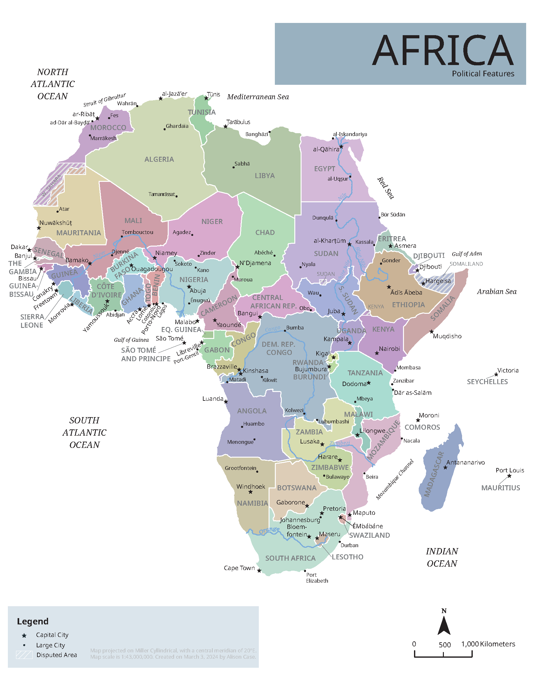
This reference map of Africa shows the continent's political boundaries and major rivers. I developed the map in ArcGIS Pro and Adobe Illustrator – with shapefiles from Natural Earth – for my Introduction to Cartography course at the University of Wisconsin–Madison.